
Our mission is to challenge the status quo of traditional measurement methods.
Bringing global expertise in forensics, design, construction, and technology, 3D Data Pro formed in 2012. With a friendly touch and a focus on client communication, the Colorado based company quickly expanded, helping clients expand their businesses, and answering critical forensic questions by connecting with rapidly expanding technologies such as 3D laser scanning (LiDAR) and drones.

About Our Director
Owner and director Steve Foltz is an architect licensed in Colorado with a background in design and forensics. His expertise includes architecture, construction documents, vehicle accident reconstruction, structure and wildland fire investigation, computer visualization and simulation, and photogrammetry technology.
Steve has extensive experience implementing LiDAR technology and geospatial sciences to build physics based, scientific visualizations representing structures and landscapes, as well as incidents and accidents. Throughout Steve’s years of experience in architecture and forensic engineering, he prepared countless 3D models and diagrams admitted by both federal and state courts.
He holds a Bachelor of Arts in Architecture from the University of Minnesota and a Master of Architecture with honors from the University of Colorado at Denver. Steve is also a commercial drone pilot. As Director of Operations for 3D Data Pro, he brings 3D expertise to the entire project cycle. Download Steve’s resume and business card by clicking here.
“Our clients often tell us the time we save on the front end enables them to grow their business and take on more renovation projects. That feedback means a lot—it shows we’re adding real value to their work, their projects, and their lives.”
- Steve Foltz, 3D Data Pro
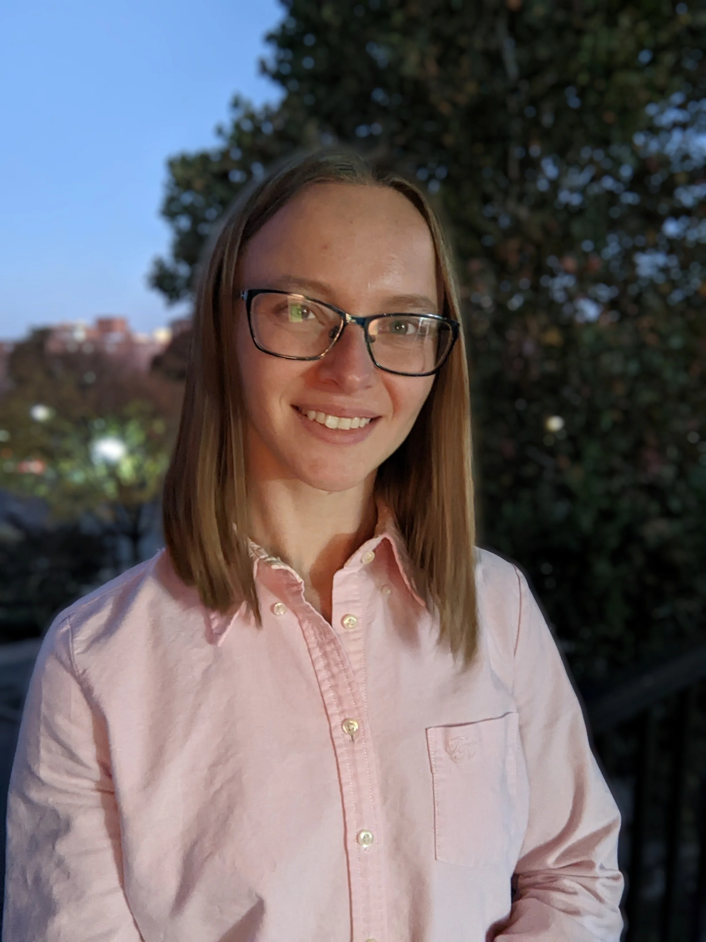
About Our Project Manager
Julia Guard is a versatile project manager known for her attention to detail and commitment to delivering results that align with each client's unique needs. With a strong background in research, point cloud processing, and modeling, she brings both analytical precision and creative problem-solving to every project.
Julia has years of experience in as-built documentation and point cloud technologies, supported by a Bachelor of Science in Architecture from the University of Cincinnati’s renowned DAAP program. Her technical expertise is matched by a deep understanding of the built environment, making her an asset to any project team.
Outside of work, Julia is an avid rock climber, enthusiastic board gamer, and dedicated DIY-er. She’s also a proud pet parent to two cats and takes every chance she gets to enjoy the outdoors.
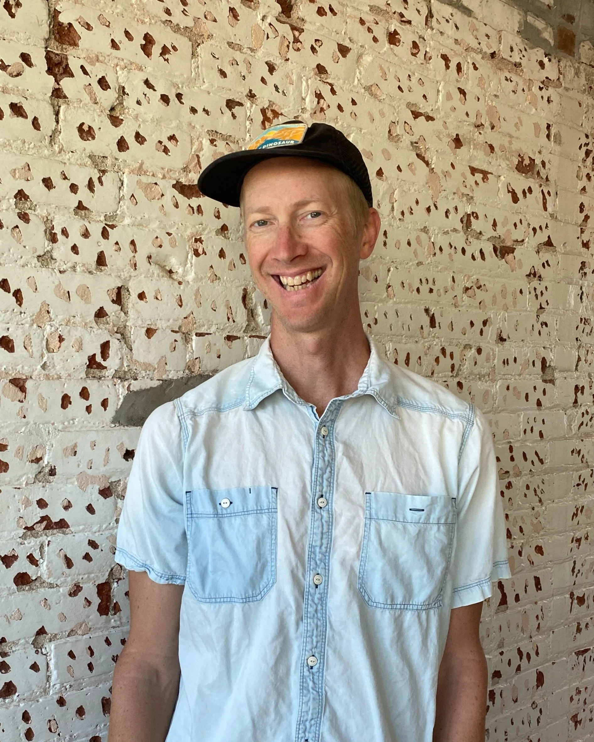
About Our Surveyor
Will Koster is an architectural surveyor at 3D Data Pro, bringing over a decade of hands-on construction experience to the field of as-built documentation and architectural surveying. His practical background gives him a strong understanding of building systems and field conditions, which enhances the accuracy and efficiency of every project.
In 2024, Will earned his FAA Part 107 Remote Pilot Certificate, adding commercial drone operations to his surveying toolkit. His multidisciplinary approach combines technical precision with real-world building knowledge.
Before joining 3D Data Pro, Will spent years as a touring musician with the band Trout Steak Revival. These days, he continues to write and record music in his home studio. In his free time, you’ll find him fixing up his vintage truck camper or enjoying the Colorado mountains with his wife.
Our Mission
Our mission is to challenge the status quo of traditional measurement methods. We accomplish this by providing a lower cost alternative to traditional measurement that mitigates risk, adds confidence, increases efficiency, safety, and profitability.
We connect with your measurement and level of detail needs (LOD/LOA) and existing workflow (Revit or AutoCAD template, families, layers). By including the latest 3D technologies (LiDAR, GPR, UVA, sUAS, LiDAR, GNSS) we provide a deliverable that is accurate, beautiful, and useful for the long term. Our 360 tours (Matterport tours) will save you time and money, allowing you to visit 100% of the interior and exterior of the site from your desk.
It is through excellent communication and top notch technology that we build a strong relationship with you. Designers are able to take on more projects because of 3D Data Pro’s pre-con services. Clients involved in litigation receive accurate analysis with clear visualizations. Visit our case studies page to see examples of our work. Ready to get started? Let’s do it!

3D Data Pro Recent Projects
[ Project Name, Project Type, Location, Area (SF), Scope of Work, Systems Documented ]
1 University of Wyoming School of Engineering As-built documentation Laramie, Wyoming 250,000 LiDAR site survey, systems photo documentation, Revit as-built modeling Architectural, structural, mechanical
2 Tantra Lake Apartments As-built documentation and visualization Boulder, CO 145,000 LiDAR site survey, systems photo documentation, Revit as-built modeling, data geolocation, drone aerial orthophotography, 360 tour visualization Architectural, structural, mechanical, electrical
3 Overlook At Thornton As-built documentation and visualization Thornton, CO 180,000 LiDAR site survey, systems photo documentation, Revit as-built modeling, data geolocation, drone aerial orthophotography, 360 tour visualization Architectural, structural, mechanical, electrical
4 NIST Wing 5 As-built documentation and visualization Boulder, CO 80,000 LiDAR site survey, systems photo documentation, Revit as-built modeling, 360 tour visualization Architectural, structural, mechanical, electrical
5 HEB Grocery Stores As-built documentation and visualization San Antonio, TX, College Station TX, Boerne, TX, Over 600,000 LiDAR site survey, systems photo documentation, data geolocation, drone aerial orthophotography, 360 tour visualization Architectural, structural, mechanical, electrical, feasibility and condition reports
6 Johnson Wales Campus Building As-built documentation and visualization Denver, CO 180,000 LiDAR site survey, systems photo documentation, 360 tour visualization Architectural, structural, mechanical, electrical
7 Paul Derda Recreation Center Building movement measurement and analysis Broomfield, CO 80,000 LiDAR time-stamped data collection, high precision altimeter data collection, photo documentation, drone aerial conditions documentation, 360 tour Architectural, structural
8 Elks Lodge #224 As-built documentation and visualization Aspen, CO 35,000 LiDAR site survey, systems photo documentation, 360 tour visualization, as-built Revit modeling and detailing Architectural, historic preservation details
9 Oil Work Over Rigs, Equipment, and Documentation of Incident and Accidents Forensic Engineering Texas, New Mexico, Colorado, Wyoming, Montana, Oklahoma Each site is approximately 2 acres LiDAR site and asset survey, evidence photography, drone orthophotography and oblique imagery, 360 tour visualization, graphics and animations for civil litigation Evidence documentation, land survey, structural and topographical modeling, accident scene diagrams, animations
10 Amazon Site Assessments Feasibility Studies for Prospective Amazon Go Stores USA Each site was approximately 6,000-10,000 LiDAR site survey, systems photo documentation, Revit as-built modeling, data geolocation, drone aerial orthophotography, 360 tour visualization Architectural, structural, mechanical, electrical, feasibility and condition reports
11 Vehicle incident and accident scenes Forensic Engineering USA Each site is approximately 1 acre Completed hundreds of site surveys using total stations, drone technologies, LiDAR technologies, topographical modeling, data geolocation. Followed by camera matching photogrammetry, 3D post processing, 3D modeling, graphics and animations for admission into civil and criminal litigation and arbitration Evidence documentation, land survey, building as-built documentation and visualization
12 Marshall Fire Forensic Engineering Boulder County, CO 200 acres (area of origin only) LiDAR site and asset survey, evidence photography, drone orthophotography and oblique imagery, 360 tour visualization of the site and witness vantage points. Evidence documentation, land survey, building as-built documentation and visualization

3D Data Pro’s Pledge To Safety
Each one of our survey technicians makes the pledge below.
Protection of Equipment & Property
I will protect our client’s property.
When possible, I will park away from client vehicles, secure doors, and return keys as required. In residences, I will complete the interior first, wear booties indoors, and clean tripod feet before entry. I will give a business to every client, home owner, or site contact during my introduction.
I will protect company equipment.
I will stage equipment safely, secure it during breaks, bring all gear indoors overnight, and never leave equipment unattended in a vehicle overnight at a hotel or home.
Stop Work If Needed
No schedule, budget, or client expectation outweighs personal safety. I will stop work and notify the project lead if hazards emerge or conditions change.
I will ask for help when needed.
While most surveys are completed by a single technician, some tasks require two people. I will identify these situations during pre-site planning or a site walk-through and request assistance when appropriate.
Site Awareness
I will complete a site walk-through before setting up equipment. I will identify hazards such as electrical lines, traffic conditions, trip and fall hazards, snow or ice, and other site-specific risks.
I will stay aware of my surroundings. I will pause in a safe location before using the tablet or phone and keep my eyes up while moving through the site. I will remain alert to subcontractors, unsecured edges, equipment staging areas, cords, shoring, rebar, and other temporary conditions, and will notify nearby workers of my presence.
Specific Hazard Controls
I will take precautions when working around vehicles. I will wear a high-visibility vest, notify vehicle operators of my presence, and remain alert in traffic areas.
I will follow safe practices when working at height. I will inspect ladders before use, set them on stable surfaces, maintain three points of contact, and avoid overreaching. I will not access roofs or elevated areas alone when a spotter is required and will decline access if conditions are unsafe.
I will respect electrical and confined-space hazards. I will maintain safe distances from exposed electrical systems and will not enter confined spaces without appropriate assessment, permission, and ventilation.
Communication
I will maintain clear communication at all times. I will check in at the start and end of each site visit and notify the team if conditions change, work runs longer than expected, or the scope of work is altered by the client, onsite contact, or building ownership. I will return keys, badges, and sign out as required each day.
I will report near misses and incidents regardless of severity. I will report close calls via text or email so we can learn from them and improve safety on future jobsites.
Personal Protective Equipment
I will use appropriate personal protective equipment (PPE).
I will have required PPE available, including a high-visibility vest, gloves, boots, hard hat, safety glasses, knee pads, and respirator. PPE will be worn as conditions require, including during ceiling tile removal and on active construction sites.
Health, Fatigue, & Readiness
I will manage fatigue and stress. I will take breaks as needed, stay hydrated, and step away when necessary to maintain focus and safety.
I will only work when fit for duty.
I will work only when I am healthy, well-rested, and mentally prepared. If I am not fit for duty, I will communicate and reschedule.
Emergency Preparedness
I will be prepared to respond to emergencies. I will know the site address, emergency exits, and nearest hospital, and will carry a charged phone and basic first-aid kit.

Why hire us?
Here is what bring to the table:
Confidence. No more tape measures and walking wheels – LiDAR is accurate to less than 1/8” and measures everything you can see.
Communication. Tell your story with confidence while referencing the online 360 tour of your site. Keep others informed using a 3D BIM model built from real world measurements.
A competitive edge. Most people are visual learners. The model you receive from 3D Data Pro will put you leaps ahead.
Safety. Your team can “visit” the job site in a 360 tour and plan accordingly.
Save time. No more return trips to the site. We will capture everything you can see in one trip. Relevant information is modeled starting with your Revit template using your object families. Civil 3D and AutoCAD are also deliverable options.
Profitability. Avoid costly change orders by designing and referencing an accurate model.
See what our clients have to say about our work by visiting the reviews page.
The 3D Data Pro Edge
The 3D Data Pro Edge
Using the most current equipment and state-of-the-art digitization techniques, along with an innovative and collaborative approach, 3D Data Pro will help you achieve an improvement in the quality, service, and effectiveness of your services. From architecture to accident reconstruction, digital scene creation to facility management, 3D Data Pro’s experience will add value to your project. Ready to connect? Find us here.
